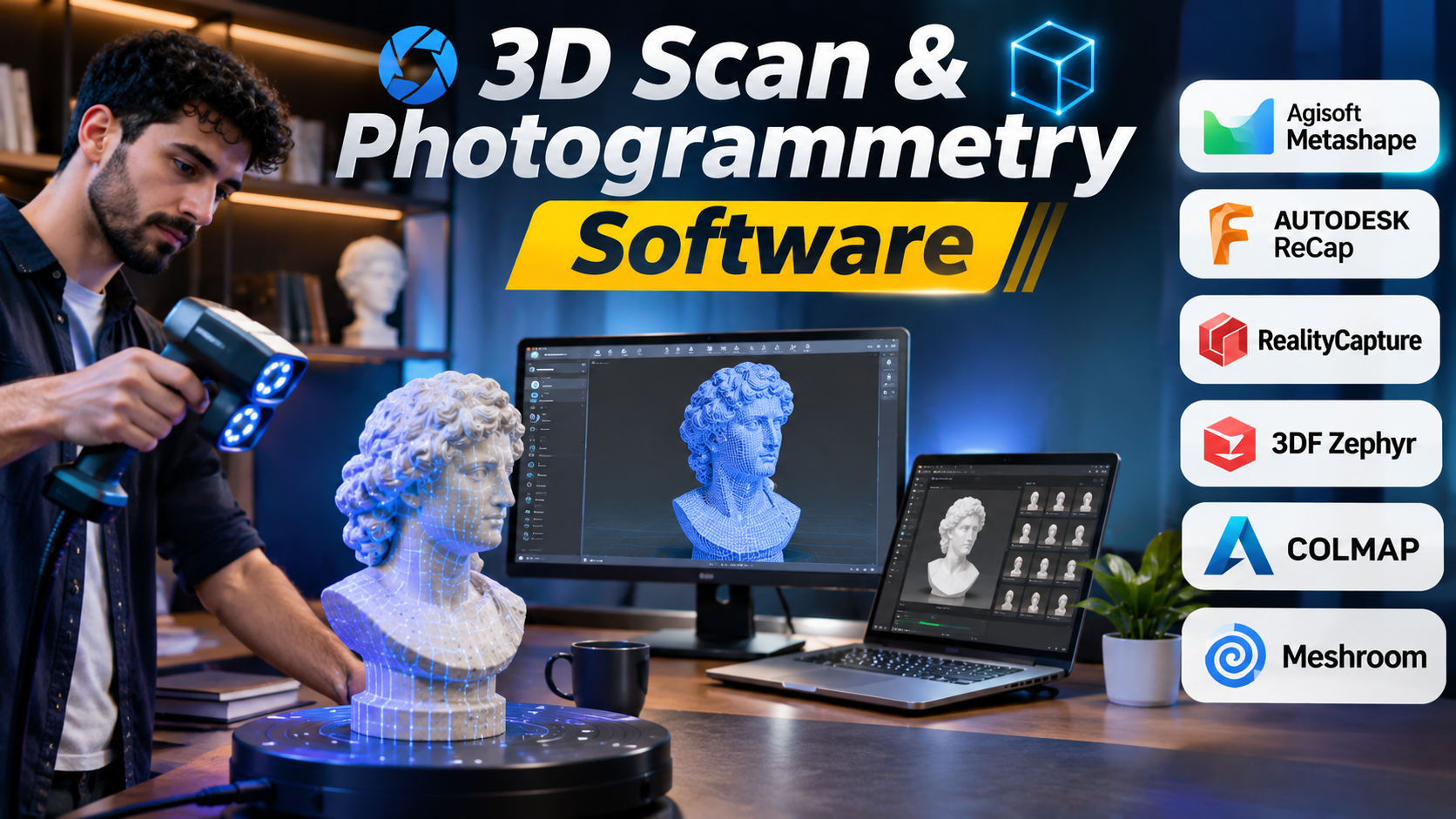
Turning a real object into a digital 3D model sounds simple. Take several photos, process them with software, and export the result. In practice, the process involves many decisions that affect accuracy, detail, cost, and usability.
A small product model for an online store has different requirements from a drone survey of a construction site. A museum may need realistic surface textures, while an engineer may care more about precise measurements.
3D scanning and photogrammetry software help turn real-world objects, buildings, and landscapes into digital models. However, not every tool works the same way.
Some applications build models from overlapping photographs. Others process data from laser scanners. Several combine both methods.
This guide explains the main technologies, compares established software options, and helps you select a suitable workflow.
Understanding 3D Scanning and Photogrammetry
3D scanning is a broad term for capturing the shape of a physical object or environment.
Photogrammetry is one method of doing this. It uses photographs taken from different positions to calculate the location of points in three-dimensional space.
Although these technologies often work together, they have important differences.
| Technology | How it works | Common applications |
|---|---|---|
| Photogrammetry | Reconstructs 3D geometry from overlapping photographs | Product modeling, heritage preservation, drone mapping |
| Laser scanning | Measures distances using laser-based sensors | Architecture, construction, industrial inspection |
| Structured-light scanning | Projects light patterns onto surfaces to measure shape | Small objects, reverse engineering, manufacturing |
| LiDAR | Uses laser measurements to capture spatial data | Surveying, infrastructure, terrain mapping |
| Hybrid reconstruction | Combines images and scan data | Complex buildings, detailed site documentation |
Photogrammetry is attractive because it can work with ordinary cameras. It can also produce detailed color textures.
Laser scanning is often better suited to environments where reliable geometric measurements are essential.
Neither approach guarantees accurate results automatically. Camera quality, calibration, capture technique, processing settings, and measurement control all matter.
What Happens During a 3D Reconstruction Workflow?
Most photogrammetry projects follow a similar process.
Looking From All Angles: ArtLens Exhibition Embraces Photogrammetry | by Cleveland Museum of Art | CMA Thinker | Medium
1. Capture images or scans
Collect overlapping photographs or measurements from different positions. Ensure the subject has enough visible detail.
The Epic Games Ecosystem for Arch Viz – Part 1 | Tutorial
2. Align images and cameras
The software identifies shared features and estimates camera positions. This creates an initial spatial reconstruction.
Factum Foundation | LinkedIn
3. Generate a point cloud
The application calculates additional 3D points to describe the captured surface.
Hyper3D Rodin: A Game-Changer in AI 3D Model Generation | PixelDojo News
4. Build and refine the mesh
A polygon mesh is created from the reconstructed geometry. Unwanted surfaces and scanning errors may need cleanup.
Bust — EinScan-Pro (Handheld Rapid High) – 3D model by 3D Scan Expert (@3dscanexpert) [f2ad9aa] – Sketchfab
5. Apply textures and export
Photographs provide surface color. The final model can be exported for visualization, editing, measurement, or other work.
The final output may be a textured mesh, point cloud, digital elevation model, orthomosaic, or another data product.
The correct output depends on the project. A beautiful mesh is not necessarily suitable for engineering measurements.
Leading 3D Scan and Photogrammetry Software
The software market includes commercial platforms, research-oriented applications, and open-source tools.
The following products serve different parts of the reconstruction workflow. They should not all be treated as direct substitutes.
1. Agisoft Metashape
Agisoft Metashape – 3D Models, Photomaps & Laser Integration – Latnet Technologies
Integrated Surveying, from Laser Scanning to UAV Systems, for Detailed Documentation of Architectural and Archeological Heritage
Sistem A.Ş. – İHA – LiDAR ve Fotogrametri Sistemleri – Agisoft Metashape Professional Edition
Agisoft Metashape is a desktop photogrammetry application used to process digital images into spatial data.
It supports projects ranging from small object reconstruction to aerial mapping.
Its workflow includes image alignment, point cloud generation, mesh construction, and texture creation. Professional geospatial workflows can also produce orthomosaics and elevation data.
Where it stands out: Metashape offers a broad workflow that connects visual reconstruction with mapping and measurement tasks.
It is particularly useful for surveying teams, researchers, and professionals who need several types of output from one project.
Large datasets can demand substantial processing power. Users also need to understand camera calibration, coordinate systems, and quality-control settings.
Consider it when: Your work combines photogrammetry, geospatial data, and detailed 3D reconstruction.
2. RealityScan
RealityScan | 3D modely z fotografií a laserových skenů
Capturing Reality s.r.o. – The Best Photogrammetry Software for All
RealityCapture : une série de tutoriels vidéo pour découvrir l’outil de scan 3D – 3DVF
RealityCapture became known for high-performance photogrammetry processing. The desktop product has since been brought under the RealityScan name.
The software is designed to reconstruct detailed models from photographs and supported scan data.
It is used in digital content creation, cultural heritage work, and large-scale reconstruction projects.
Where it stands out: Its focus on efficient reconstruction makes it attractive for teams that need detailed 3D assets from extensive image collections.
It is especially relevant when reconstructed models will be used in visual effects, interactive environments, or real-time 3D production.
Users should confirm current licensing, hardware requirements, and supported import formats before adopting it. Product naming and commercial terms have changed over time.
Consider it when: Your main goal is producing detailed digital assets from real-world subjects.
3. Autodesk ReCap Pro
Recap Pro – Features, Reviews & Pricing (February 2026)
Registration of multiple unstructured photogrammetry scans – Autodesk Community
How Scan-to-BIM Enhances Accuracy and Efficiency in Commercial Renovations? | by Ratinder kaur | Medium
Autodesk ReCap Pro is a reality-capture application that helps users work with scan data and point clouds.
It is closely associated with architecture, engineering, and construction workflows.
Its value is not simply in creating attractive 3D models. It helps turn captured site conditions into information that can support design and documentation.
ReCap can be useful when scan data needs to move into other Autodesk applications.
Where it stands out: Integration with Autodesk-oriented design workflows is a major reason to consider it.
However, it is not a direct replacement for every specialist photogrammetry or mesh-generation application.
Its suitability depends on the scanner, source data, required outputs, and the Autodesk products used by the team.
Consider it when: Your organization works with building scans, point clouds, and Autodesk-based design processes.
4. 3DF Zephyr
3D Zephyr 3.7 Available Now
3DF Zephyr Lite Steam Edition on Steam
3DF Zephyr Lite Steam Edition on Steam
3DF Zephyr, developed by 3Dflow, provides an image-based reconstruction workflow.
It can generate 3D models from photographs and offers tools for processing, editing, and exporting reconstructed data.
Its product editions serve different levels of use, from smaller projects to professional workflows.
Where it stands out: Zephyr provides a guided environment for photogrammetry while offering more advanced tools for users who need them.
It can be a practical choice for education, object digitization, cultural heritage, and technical reconstruction.
The available features and image-processing limits depend on the edition. Buyers should compare those restrictions before choosing a license.
Consider it when: You want a dedicated photogrammetry application with a structured reconstruction workflow.
5. COLMAP
COLMAP多视角视图数据可视化_相机位姿 可视化软件-CSDN博客
Sparse model looks good, but find holes/disconnections in the dense model · Issue #1047 · colmap/colmap · GitHub
HLOC + GLOMAP Repo
COLMAP is an open-source photogrammetry tool focused on structure-from-motion and multi-view stereo.
Structure-from-motion estimates camera positions and scene geometry from photographs. Multi-view stereo adds more detailed surface information.
COLMAP is widely relevant to research and computer vision workflows.
Where it stands out: It offers transparency, technical flexibility, and access to established reconstruction algorithms.
Researchers and developers can use it as part of larger automated pipelines.
However, COLMAP is not designed to provide the same complete, guided production experience as every commercial photogrammetry suite.
Users may need other software for mesh editing, texture preparation, and final asset delivery.
Consider it when: You need an open-source reconstruction engine or want to build a custom technical workflow.
6. Meshroom
Labcom Alicia-Vision
[Photogrammetry] Meshroom 2023.1 released – Prof. Peter L. Falkingham
Meshroom 2025.1.0 – 3D Modeling Tools – FileEagle
Meshroom is an open-source photogrammetry application built around the AliceVision framework.
It uses a node-based workflow. Each node represents a processing stage, such as feature extraction, camera reconstruction, or mesh generation.
This approach makes the reconstruction pipeline easier to inspect and modify.
Where it stands out: Meshroom gives technically curious users a visual way to understand the processing steps behind photogrammetry.
It can be useful for education, experimentation, and creative projects.
Hardware support requires attention. Some processing stages depend on compatible GPU technology, and installation requirements may differ across operating systems.
Consider it when: You want an open-source workflow with visible, adjustable processing stages.
7. Pix4Dmapper
Interview: how a firefighter is using drones in US cities | Pix4D
Software para procesamiento fotogramétrico Pix4D
Smart city initiatives and drones: a perfect match | Pix4D
Pix4Dmapper is designed primarily for image-based mapping and surveying.
It processes aerial and terrestrial photographs to produce geospatial outputs such as point clouds, orthomosaics, and surface models.
This makes it different from software focused mainly on creating textured 3D objects.
Where it stands out: Pix4Dmapper is suited to workflows where location, scale, and measurement matter.
Typical applications include drone surveying, construction documentation, and terrain mapping.
Accurate results still depend on capture planning, ground control, coordinate systems, and appropriate quality checks.
It may be excessive for someone who only wants to create a small 3D product model.
Consider it when: Your priority is aerial mapping and measurable geospatial data.
8. OpenDroneMap
WebODM – Drone Mapping Software
Processing options for high quality 3D model – OpenDroneMap Desktop – OpenDroneMap Community
Same images different results – OpenDroneMap Desktop – OpenDroneMap Community
OpenDroneMap is an open-source toolkit for processing aerial imagery.
It can generate maps, elevation models, point clouds, and other reconstruction outputs from drone photographs.
WebODM provides a browser-based interface for managing many of these processing tasks.
Where it stands out: OpenDroneMap gives technically capable teams greater control over their mapping infrastructure.
It can be attractive to organizations that prefer open-source tools or want to process data within their own environment.
The trade-off is operational responsibility. Installation, computing resources, updates, and troubleshooting may require technical knowledge.
Consider it when: You need an open-source aerial mapping workflow and can manage the supporting infrastructure.
Comparing the Software by Practical Use Case
Choosing between these applications becomes easier when you focus on the final deliverable.
| Software | Primary strength | Suitable users | Main consideration |
|---|---|---|---|
| Agisoft Metashape | Photogrammetry and geospatial reconstruction | Surveyors, researchers, 3D specialists | Processing demands and technical settings |
| RealityScan desktop | Detailed 3D asset reconstruction | Game developers, visual effects teams | Licensing and workflow compatibility |
| Autodesk ReCap Pro | Point cloud and reality-capture workflows | Architects, engineers, construction teams | Autodesk ecosystem and source-data compatibility |
| 3DF Zephyr | Guided photogrammetry reconstruction | Educators, designers, digitization teams | Edition-specific limits |
| COLMAP | Open-source reconstruction algorithms | Researchers, developers | Additional tools may be needed |
| Meshroom | Node-based photogrammetry | Students, artists, technical users | Hardware and pipeline requirements |
| Pix4Dmapper | Drone mapping and surveying | Mapping and geospatial professionals | Geospatial expertise and cost |
| OpenDroneMap | Open-source aerial image processing | Drone teams, technical organizations | Setup and maintenance |
These products are not ranked by overall quality. Their value depends on the project.
For example, COLMAP may be an excellent foundation for a research pipeline but less convenient for a designer who wants a ready-to-use textured asset.
Similarly, Autodesk ReCap Pro may fit a building documentation workflow better than an application designed mainly for small-object photogrammetry.
The Most Important Features to Evaluate
Accuracy and measurement reliability
Accuracy is not the same as visual detail.
A model may look realistic while containing measurement errors. This matters when the data will be used for construction, surveying, or engineering.
Look for support for control points, coordinate systems, scale constraints, and quality reports when measurement is important.
A controlled test using known dimensions can reveal more than a product demonstration.
Image alignment and reconstruction quality
The software must identify enough shared features between images to reconstruct the subject.
Low-texture surfaces, reflections, motion blur, and poor lighting can cause problems.
A useful evaluation should include photographs from the actual camera and environment you plan to use.
Processing speed and hardware requirements
Photogrammetry can place heavy demands on CPUs, GPUs, memory, and storage.
Large image collections often create much larger intermediate datasets.
Check whether the software supports your hardware and whether its processing stages can use available GPU resources.
For commercial teams, processing time can affect project costs as much as the license itself.
Export formats and compatibility
The reconstructed model is usually only one stage of a larger workflow.
Common outputs include:
- Point clouds for measurement and spatial analysis.
- Polygon meshes for visualization and 3D editing.
- Textured models for interactive applications.
- Orthomosaics for mapping.
- Elevation models for terrain analysis.
Confirm the actual supported formats and whether they preserve scale, coordinates, textures, and other required information.
Automation and repeatability
Manual processing may be acceptable for occasional projects.
Organizations processing hundreds of datasets need more repeatable workflows.
Command-line tools, scripting, batch processing, and consistent configuration settings can reduce manual work.
COLMAP and OpenDroneMap are particularly relevant when developing custom processing pipelines.
Data privacy and control
Photographs and scan data may contain sensitive information about buildings, industrial facilities, or private properties.
Before using cloud-based processing, check where data is stored, who can access it, and how long it is retained.
Local processing may provide greater control, but the organization must still manage security and backups.
Why Good Photographs Matter More Than Many Software Settings
Poor capture quality is one of the most common reasons reconstruction projects fail.
Photogrammetry depends on finding recognizable features across multiple images.
When the images are blurry, inconsistent, or poorly overlapped, the software has less reliable information to work with.
For small objects, a practical capture approach is to photograph the subject from several heights and angles.
Keep lighting consistent. Avoid strong reflections and moving shadows. Capture hidden areas rather than assuming the software can recreate them.
For aerial projects, plan image overlap and camera positions before flying. Consider ground control when accurate measurements are required.
More photographs do not automatically mean a better model. A smaller collection of well-planned images can be more useful than a large collection with weak coverage.
Common Problems in 3D Reconstruction
Reflective and transparent surfaces
Glass, polished metal, and glossy objects are difficult to reconstruct through ordinary photogrammetry.
Reflections change as the camera moves, making it harder to match image features.
Specialized capture techniques or different scanning methods may be necessary.
Missing geometry
If the camera cannot see the underside or back of an object, the software cannot reliably reconstruct those areas.
Capture planning should include the full geometry needed in the final model.
Excessive polygon counts
Dense meshes can become difficult to edit or use in real-time applications.
Reducing polygon counts while preserving important detail is often necessary.
Incorrect scale
A model generated from photographs may not have a reliable real-world scale without additional measurements or reference information.
This is especially important for surveying and engineering work.
Inconsistent textures
Changing light conditions can create visible seams or color differences.
Consistent exposure and controlled lighting improve texture quality.
Choosing Between Commercial and Open-Source Software
Commercial applications often provide integrated workflows, vendor support, and interfaces designed around specific professional tasks.
Open-source applications provide flexibility, source-code access, and opportunities for customization.
However, neither approach is automatically cheaper or better.
| Decision factor | Commercial software | Open-source software |
|---|---|---|
| Initial software cost | May require a paid license | Often available without license fees |
| Technical setup | Often packaged for end users | May require configuration |
| Customization | Depends on vendor features and APIs | Can offer deeper code-level control |
| Support | Vendor support may be available | Community or third-party support |
| Maintenance | Product updates managed by vendor | Users may manage deployment and dependencies |
| Workflow integration | Often designed around established use cases | May require combining multiple tools |
For a small creative studio, a commercial tool may save enough processing and troubleshooting time to justify its cost.
For a research group developing new reconstruction methods, access to open-source algorithms may be more valuable.
The right decision depends on the total effort required to deliver usable results.
A Practical Software Selection Framework
Before purchasing a license or building a workflow, answer four questions.
What are you capturing?
Small objects, large buildings, and aerial landscapes require different equipment and software capabilities.
What will you do with the result?
A textured asset for a game needs different processing from a measured terrain model.
How accurate must the output be?
If measurements affect engineering or construction decisions, establish a clear accuracy requirement and verification process.
Who will operate the software?
A specialist may benefit from advanced controls. An occasional user may need a simpler interface and more guided processing.
A short pilot project is the most reliable way to evaluate the available options.
Use the same representative dataset in each candidate application. Compare the resulting geometry, processing effort, hardware requirements, and export compatibility.
Avoid relying only on promotional example models.
Where 3D Scanning and Photogrammetry Deliver Value
The technology supports several industries, but each has different expectations.
In architecture and construction, captured site conditions can support documentation and design coordination.
In cultural heritage, detailed 3D models can help preserve the appearance of historical objects and structures.
In game development and visual effects, photogrammetry can create realistic assets based on physical subjects.
In surveying, aerial imagery can support mapping and terrain analysis when captured and processed with suitable controls.
In manufacturing, scanning can support inspection and reverse-engineering workflows, although dedicated metrology systems may be required for strict dimensional tolerances.
These differences explain why there is no single software package that is ideal for every project.
Making the Right Choice
The best 3D scanning or photogrammetry workflow starts with the output you need, not the longest feature list.
For broad image-based reconstruction and mapping, Agisoft Metashape is worth evaluating. For detailed digital assets, RealityScan desktop and 3DF Zephyr are relevant options.
Autodesk ReCap Pro fits workflows centered on scan data and building documentation. Pix4Dmapper focuses on mapping and surveying.
COLMAP, Meshroom, and OpenDroneMap offer different open-source approaches for users who value flexibility and technical control.
Before committing, test a real dataset, inspect the geometry, verify scale where necessary, and confirm that the output works in your next application.
A successful reconstruction is not simply a realistic-looking model. It is a model that meets the technical needs of the project and can be used reliably in the next stage of work.